Services Provided
Limited Percolation Feasibility Study
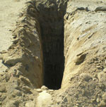
Test to determine the rate at which liquids "percolate" into a subject soil for septic disposal. Repeated tests are taken in each test pit to determine a minutes per inch quotient which corresponds to a rate. That rate will determine how large the septic system must be accommodate the proposed dwelling.

Percolation tests are designed to simulate the conditions of a septic system. Tests are performed in natural ground. Generally soil with a balance of fine and coarse grain makes the best septic field. Soils heavy with clay content drain very slowly and do not make good septic fields.

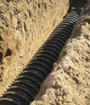
Via Leach Line: Leach lines run parallel with the surface of the ground. They are normally installed 3 to 5 feet deep from existing surface. Length of leach lines corresponds to the size of the septic tank and the test rate.
Via Seepage Pit: Seepage pits are approximately 6 feet in diameter and vary in depth from 10 to 40 feet. Depth and number of pits are determined by test rate and septic tank size.
We also provide testing and design for Mound and Alternative Systems.
Compaction Testing
Testing and observation by a soils technician during grading or backfill of trenches to insure correct placement of the soil.

Compaction occurs when the air is forced out of the soil during compression (usually heavy machinery). Testing determines whether or not the soil will support heavy loads.
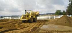
A sample of the soil is taken before work begins and a maximum density and optimum moisture content are determined by laboratory test. Soil is then removed in the desired area of the site to a depth that is impermeable, and replaced in "lifts" which are compacted with heavy machinery. Each "lift" is tested to insure soil stability before the next lift is placed. Adequate compaction is determined by testing the in-situ density of the soil and comparing it to the maximum density determined by a laboratory test. In-situ testing is performed by one of two methods, Sand Cone or Nuclear Gauge.
Hydrology
Hydrology is principally concerned with the precipitation of water onto the land and how the land is affected. Hydrology may be used to determine the movement and extent of contamination from landfills, mine runoff, and other potentially contaminated sites to surface and subsurface water.
Hydrology includes the study of the amount and flow of groundwater as well as precipitation. It is used to predict and mitigate flood risk and to design bridges, sewer and dams. For our application, it is used to determine the necessity and size of drainage pipes on a subject property.
Preliminary Geotechnical Soils Evaluation
Evaluation developed by review of available literature, reports, and maps pertinent to the site as well as samples collected at various depths.

Samples are tested for Laboratory analysis for shear strength, maximum density, soluble sulfate, and expansive potential.
Evaluation is site specific and includes recommendations for foundations, soil removals, seismic information, historical groundwater as well as standard grading and earthwork specifications.
Preliminary Soils Reports are generally required during the planning stages of a project.
Additional Services
R-Value Test to determine recommendations for asphalt/pavement sections for streets and/or parking lots.
Phase 1 Site Assessment of the subject property to determine if any former or current usage has resulted in any type of contamination requiring remediation.
Phase II Site investigation by geological and geotechnical engineers to ascertain subsurface exposures to chemicals.
Grading Plans A "blueprint" for ground preparation prior to building. Indicates where ground is to be removed and/or "filled in" to allow the best possible use of the site. Also shows existing and proposed topography, improvements, demolition and environmental controls.
Erosion Control Plans
Drainage Plans
Parcel Mergers
Lot Splits
Tentative Parcel Map
Feasibility Trenches/Borings
Septic Designs
Permanent Foundation Certifications
Grading Exemption Certifications
and more!
